01
Map viewer
Orthomosaics, elevation models and vector layers in one browser map, with basemap switching, a live coordinate readout and a compass.

Flying the site is half the job. MINFRA is where the orthomosaics, terrain models and point clouds land — measured, comparable, and open in a browser rather than sitting in a folder nobody opens twice.
Built by UNITOSFlying since 2018Data resident in India
Not a technology problem. A delivery one.
A folder of GeoTIFFs and LAS files needs a GIS desk to read. Most site teams do not have one, so the survey is looked at once and filed.
Someone re-measures the same stockpile in a different tool and gets a different number, and now there are two numbers and an argument.
Last quarter is on a hard drive somewhere. Comparing it to this quarter is a project in itself, so change gets estimated instead of measured.
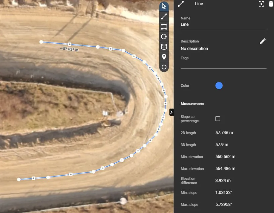
Real captures from the platform, one capability at a time. The readouts are the platform's own.
The whole site at any zoom. The orthomosaic is tiled from zoom 10 to 22 and streamed, so a 40 GB capture opens in a browser tab in the time it takes to read this sentence.
Anything not yet shipped is marked beta or roadmap wherever it appears — we would rather tell you now than have you find out later.
Orthomosaics, elevation models and vector layers in one browser map, with basemap switching, a live coordinate readout and a compass.
Point clouds streamed in the browser as Potree octrees and COPC, so a full-density LAS opens without a workstation.
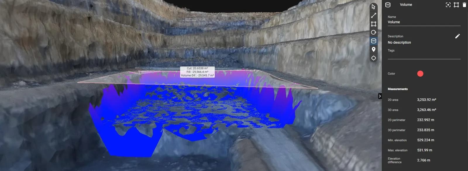
Cut and fill between two surfaces. Stockpiles and excavation measured against the previous capture rather than estimated from a photograph.
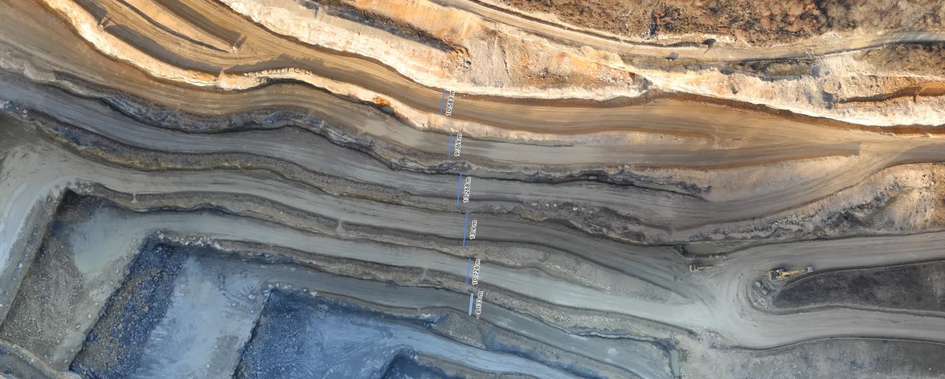
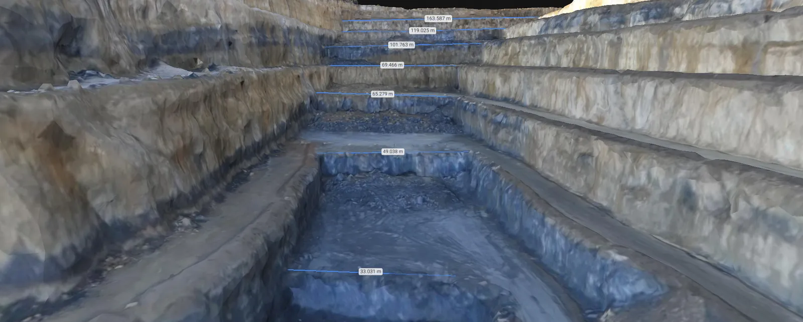
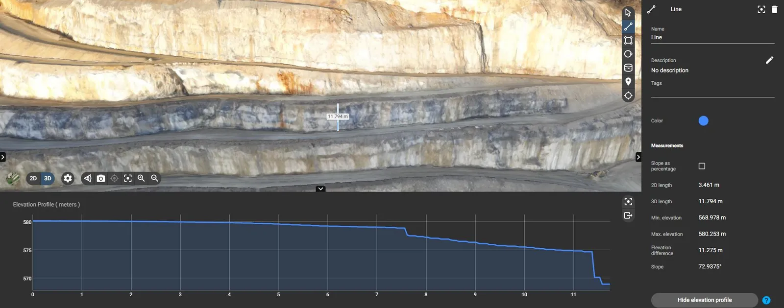
Bench height, width and slope read straight off the survey - the face measurements a mine plan is argued over.
Put two captures of the same site side by side and move through them in sequence, so change is seen rather than described.
Ask your regulatory and reference documents a question and get the answer with the document, page and clause it came from - or an honest "not in your documents".
An assistant built into the platform that reads your regulatory documents, your projects and your survey data, and answers in plain language — always showing exactly where each answer came from.
The lessee must restore the worked-out area in line with the approved mine closure plan: backfill and level the pits, stabilise the dumps, and re-vegetate the disturbed land, with progress reported each year. The financial assurance is released only once closure is certified.
Karnataka Minor Mineral Concession Rules · rehabilitation clause · open the pageIllustrative. In the platform every answer links to the document, page and clause it came from, and it says so when the answer is not in your documents.
UNITOS flies the site with DGPS and Total Station ground control.
Imagery becomes orthomosaics, terrain models, point clouds and vectors.
The project opens in a browser. No desktop GIS, no file transfer.
Measure, compare against the last capture, and share the answer.
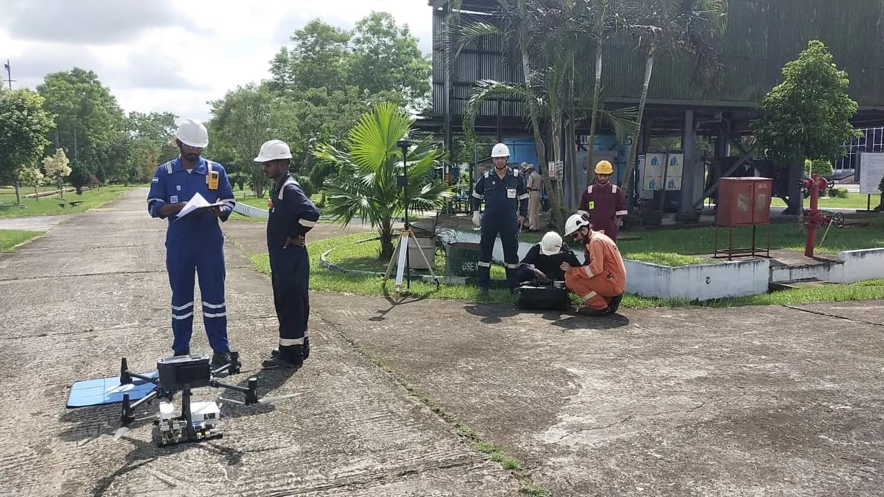
MINFRA was built for UNITOS's own delivery before it was ever a product, which is why it answers what site teams ask rather than what a GIS package can do.
We will load a capture of your ground into the platform so you are looking at your site, not a demo dataset.